Drought Status and Statewide Snowpack
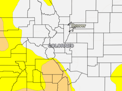
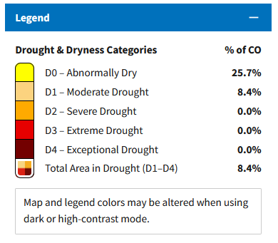
According to the March 19 update from the National Integrated Drought Information System (NIDIS), 8.4% of the state is currently in the Moderate Drought category, and 25.7% of Colorado is Abnormally Dry. The map featured above shows the drought conditions on March 19.

As of, March 11 cumulative precipitation in the Colorado River watershed was tracking at 111% of average and the South Platte River watershed was tracking at 87% of average. Snowpack in the Colorado River is tracking at 106% of normal and is tracking at 110% of normal in the South Platte River watershed.
Denver Water’s supply reservoir contents as of March 11 are represented in the table below. Reservoir totals are 83% full and were 81% full this time last year.
| Reservoir | Percent Full: Current | Percent Full: Historical Median |
|---|---|---|
| Antero | 96% | 100% |
| Eleven Mile | 102% | 102% |
| Cheesman | 86% | 95% |
| Marston | 76% | 63% |
| Strontia Springs | 87% | 93% |
| Chatfield | 92% | 58% |
| Dillon | 88% | 98% |
| Gross | 46% | 84% |
| Ralston | 87% | 87% |
| Meadow Creek | 45% | 77% |
The district will continue to work with Denver Water on monitoring the watersheds and will provide updates to our customers through our website and social media channels.
As of March 25 statewide snowpack is 108 percent of median. The median date for peak snowpack is on April 7.

Percent of median by river basin:
Yampa and White: 108
Upper Colorado: 105
Laramie and North Platte: 103
South Platte: 110
Gunnison: 105
Arkansas: 117
Upper Rio Grande: 110
San Miguel, Dolores, Animas and San Juan: 105